About

A focused technical team, decades of geophysics engineering.

Atlas Deep Geo is a focused technical team developing physics-guided seismic reconstruction methods with quantified uncertainty. Our roots are in the engineering teams that built the seismic data systems large operators have relied on for decades.

Vision & mission
Vision

Seismic imaging improves when the physics is handled carefully and the software is built to match. We develop methods at the boundary of geophysical research and production practice — working on real data, reporting what the results actually show.

Mission

To translate rigorous subsurface analysis into workflows that geoscientists can run, inspect, and trust — and that decision-makers can act on with confidence.

What we work on

The ORCA reconstruction framework is the technical center of the work. Current development is focused on 2D-to-3D seismic reconstruction — turning sparse 2D lines into probabilistic 3D volumes with calibrated P10 / P50 / P90 envelopes. Related problem classes (infill of 3D surveys with gaps, imaging beneath obscuring zones, near-offset reconstruction) are research directions we pick up alongside concrete POC engagements as they arise. We are not a SaaS vendor; there is no packaged product to license today.

How we engage

The work runs through proof-of-concept engagements with real customers on real datasets. A first POC is typically funded at a nominal level — priced as proof-of-method, not proof-of- value. Second and third engagements on the same workflow move to competitive commercial rates once the method is established for that problem class. As workflows mature, customers who use them repeatedly will want to run them in-house — license-style packaging is the eventual destination, not the starting point.

How we work

Focused technical teams. Honest validation. Documented methods. Every reconstruction we deliver is accompanied by the QC that produced it — what worked, what did not, and where the uncertainty estimates land against ground truth when ground truth exists. We publish what we can; client data stays isolated when it cannot be published.

What we believe

Subsurface decisions deserve calibrated uncertainty, not single point estimates dressed up as answers. Methods worth trusting are methods that are willing to say what they do not do. Open data, where it exists, should be used; client data, when entrusted to us, stays isolated.
The founding team

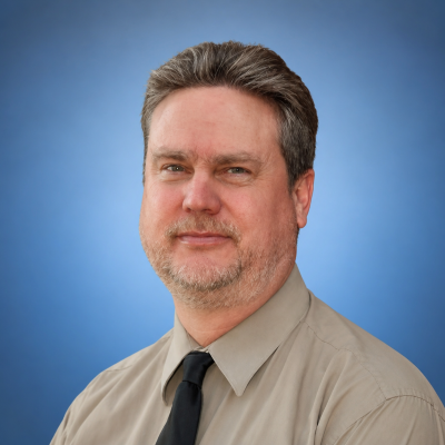
Steve Angelovich

Steve Angelovich

Co-founder · Engineering

Steve Angelovich brings thirty years of scientific computing experience to Atlas Deep Geo. He progressed from individual contributor to senior leadership of large, geographically distributed engineering teams. Along the way he held end-to-end responsibility for a major portfolio of commercial geophysical products, with accountability spanning architecture, development, delivery, and roadmap. He also led that product line through a full architectural transition, moving from on-premise deployment to cloud-native delivery without disrupting the workflows existing customers depended on.

Steve worked alongside Chuck Mosher across two organizations on JavaSeis — the open parallel I/O and computing framework that became the technical foundation for multiple generations of seismic processing work. Steve's role was on the production side. He architected the parallel I/O and computing core of a widely-deployed commercial system. The next generation of those architectural ideas now sits at the foundation of Atlas Deep Geo's stack.

His applied research includes three industry publications on machine learning applied to fault interpretation. The connecting thread across all three is calibrated uncertainty — getting AI to report not just an answer, but how much to trust it. That is the same problem Atlas Deep Geo addresses in its reconstruction work. As co-founder, Steve brings the production discipline, partnership experience, and architectural depth required to turn rigorous geophysical methods into software that performs reliably at scale.

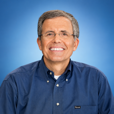
Charles Mosher

Charles Mosher

Co-founder · Geophysics

Charles Mosher brings more than four decades of geophysics research to Atlas Deep Geo, with a career built at the intersection of seismic imaging, inversion, and data reconstruction — work recognized by the SEG Fessenden Medal in 2021 and a ConocoPhillips Lifetime Achievement Award in 2018. His technical contributions span advanced imaging methods, sparse transform development, and compressive sensing reconstruction workflows that have been validated across 17 global deployments on land, marine, and ocean-bottom node surveys. With over 40 patents covering acquisition design, signal processing, and quantitative interpretation, Chuck brings to ORCA the algorithmic depth required to make physics-guided reconstruction produce results that can be inspected, calibrated, and trusted. As co-founder of Atlas Deep Geo, he leads the geophysics effort — ensuring the method is scientifically rigorous, honestly validated, and grounded in the kind of subsurface understanding that only comes from working directly with real data.

The extended team

Atlas Deep Geo draws on an extended team of engineers who spent their careers building the large-scale production systems — including the seismic processing platforms — major operators have depended on for decades.

They built those systems from the ground up. That same discipline and domain depth is what they bring to every Atlas Deep Geo engagement.

Meet the team →
EY

Ed Young

Systems Engineering · Platform Integration

Ed Young brings more than two decades of experience building and automating large-scale production software systems. His work centers on the platform engineering that keeps complex systems running reliably at scale — continuous-delivery architecture, infrastructure automation, and the test-and-deployment pipelines that let demanding software ship predictably. At Atlas Deep Geo he brings that discipline to the compute and data infrastructure behind the company's seismic-reconstruction software.

BF

Barry Fish

Core Processing Development · Execution-Logic Architecture

Barry Fish brings extensive experience in seismic processing algorithm implementation, execution-logic design, and core-module engineering. His career has been defined by an ability to take complex geophysical algorithms — often originating in research environments — and translate them into efficient, production-grade implementations that geophysicists rely on daily. His deep involvement in execution-logic architecture has shaped how processing modules interact, how data flows through systems, and how computational resources are managed — reducing technical debt and ensuring new algorithms integrate cleanly without disrupting what already works.

DD

Dave Diller

Systems Architecture · Core Processing Development

Dave Diller's influence on seismic processing software has been quiet, steady, and foundational. As a systems architect, Dave didn't just write code — he envisioned how entire processing environments should function. The modular flow structures, flexible parameter systems, and extensible algorithm frameworks that geophysicists have relied on for decades were the result of deliberate engineering choices he helped make real. His most enduring contributions lie in execution logic — how processing sequences are built, how new algorithms are added without breaking existing ones, and how systems scale without losing coherence.

Lineage and partnerships

The data architecture, the reconstruction algorithms, and the synthetic training pipeline — each with a documented lineage, each built on work already tested in production.

Partnership

MoMacMo

Joint development partnership on the core algorithms that power ORCA — how horizons are reconstructed, how the inversion is solved, and how uncertainty is measured and reported.

Lineage

JavaSeis

The Atlas data stack inherits architectural patterns from the JavaSeis seismic data framework — distributed I/O, brick-organized volumes, and the operator-framework patterns that underlie the reconstruction pipeline.

Technical partnership

DasPEG

Atlas Deep Geo collaborates with DasPEG on shared signal processing and event-detection methodology applied to distributed acoustic sensing (DAS) microseismic data. DAS is a different acquisition geometry from the reflection seismic Atlas focuses on, but the two efforts share core algorithms for event detection, uncertainty quantification, and the distributed I/O patterns underlying the reconstruction pipeline. The teams contribute to a common open-source framework and run regular joint technical sessions; where Atlas's methods need extension into the microseismic domain, DasPEG's expertise shapes the design.

Technical collaboration

Seismic Image Processing (SIP)

Atlas Deep Geo and Seismic Image Processing (SIP) are engaged in an ongoing technical collaboration combining two advanced imaging methods. eRTM — extended Reverse Time Migration, developed by the Fraunhofer Institute for Industrial Mathematics (Fraunhofer ITWM) in Kaiserslautern, Germany — produces a sharper subsurface image than conventional migration, providing a more accurate starting model and tighter constraints for inversion. ORCA-FWI, developed by Atlas Deep Geo, is a full waveform inversion workflow that exploits those better constraints directly — converging more reliably on the correct subsurface model than FWI run from a conventional starting point. Together the two methods sharpen the subsurface models the ORCA reconstruction pipeline depends on.